- I am very interested in learning the geology and earthquake-related
significance of the area we live in. This file contains my notes,
however haphazard they are. I will eventtually sort them for
better organization. First, here are the main links to the more
important sites...
-
- Home Quake Safety Toolkit - How many of us
have actually purchased a kit like this? I bet zero! Let's shop
around, compare, and all of us try to buy them in bulk to save
money .
- Recent Northern California Quakes (map) I
felt that 3.4 quake Wednesday morning 3-1-06. It was a sharp
jolt in a vertical motion, like a truck had hit my house. It
was very fast.
- I did not feel the 2.9 one after that.
- Recent Statewide Quakes (text)
- Real-time Forecast of Earthquake Hazard in the
Next 24 Hours
- Earthquake
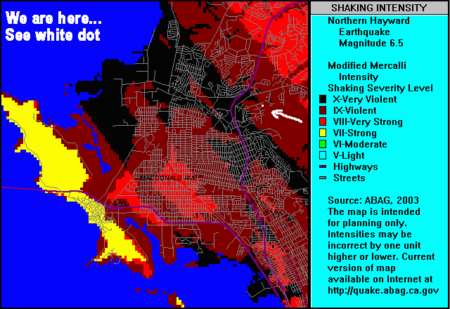
Hazard Map for Richmond/San Pablo: Scenario: North Hayward
Segment of the Hayward-Rodgers Creek Fault System
Geology notes
-
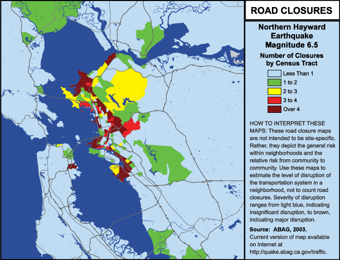
- Road closures graphic obtained from http://www.abag.ca.gov/bayarea/eqmaps/eqtrans/haym_rslt.html
- Article on Reduced Quake Risk Discovered
-
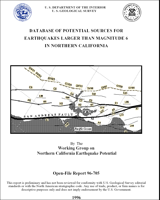
- We are in area H2 of the Northern Hayward (HN)
Fault Subsystem. USGS Database of Potential Sources for Earthquakes
Larger Than Magnitude 6 in Northern California.
-
-
-
-
-
-
-
-
-
-
-
-
-

-
- The San Francisco Bay region lies on the boundary zone between
two of the tectonic plates that make up the Earth’s outer
shell. The relentless motion of these plates builds up strain
that will eventually be released in earthquakes on the region’s
many faults. Map above shows the northwestward movement of the
Farallon Islands relative to Columbia in eastern California,
as documented by Global Positioning System (GPS) data from those
two sites. The lengths of fault that slipped in the 1868 Hayward
and 1989 Loma Prieta magnitude 6.9 earthquakes areshown in yellow.
-
-

- We are between the Northern Hayward Fault
and the Wildcat Canyon Fault, also next to the Mulholland syncline.
-
- Our Pleistocene-era "ancient deposit" bedrock consists
of landslide deposits of sheared claystone and minor sandstone.
-
- Geologists have labeled our area as LhF and consists
of Los Osos Clay Loam with 30-50% slopes. Formed in material
weathered from clay loams from interbedded sedimenttary rock
on uplands. I have seen 3 specific terms for our soil : Alo clay,
Lodo clay and Mulholland loam. I don't know yet which one we
are on.
-
-